

 |
| Loading Wheat, Prince Rupert, BC |
It was another sunny day, which began calm, but quickly developed a perfect wind. We sailed south on a reach with a west to northwest wind of force 4. The first time we looked up at the wind vane on our masthead we discovered that half of it was missing! The most likely explanation is that an eagle tried to sit on it; there were a dozen or more eagles hanging around the harbor. Well, we still hadn’t taken down the dozen flags we were flying on Canada Day, so we have plenty of wind vanes.
We sailed to the southern end of Chatham Sound, and when we turned to go down Malacca Channel the sail changed from a reach to a run. Rather than putting up the whisker pole, we furled the mainsail, and ran with just the jib. There was plenty of wind to keep us moving at 5-6 knots, and this is no race. Our tentative destination had been Lawson Harbour, but it is open to the north, and the seas were rolling right in there, so we kept on going. We passed half a dozen power and sailboats headed north. This is the main inside passage route. By now the wind was up to force 5, and we were tearing along at hull speed or greater, with whitecaps and big waves pushing us about on the stern.
 |
| Gunboat Harbour, Gibson Is, BC |
Jean took Schooner ashore for a long walk on an ebbing tide, and when she returned to the dinghy it was high and dry in a field of barnacle-covered, basketball-sized boulders. It took a lot of effort to get it back into the water, rolling it on scavenged driftwood logs, trying to avoid doing too much damage to the boat. Our dinghy is definitely not a showpiece – it’s a work horse.
 |
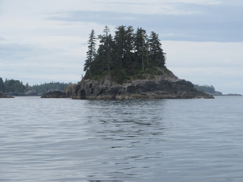
| Petrel Channel, BC |
Saturday, July 4th, for a change, we didn’t have any Independence Day activities to enjoy. First, we are in Canada, and secondly nobody lives here. We left early to get the last of the ebb current south down Ogden Channel. We scurried across in front of a tug and barge, and made it with some room to spare, though they are always going a lot faster than we think. The sailing was similar to yesterday; it began calm, but the wind soon came up, and rapidly increased as the morning progressed. We once again used only the jib, mostly on a broad reach, and we were really smoking along. Another sunny day. We turned into Petrel Channel, and by the time we reached the narrow bit, the tide was running against us at nearly 2 knots. But we were sailing 6 or more, so it was not a big problem.
 |
| Rover, Newcombe Harbour, BC |
Around noon we enter the narrow and obscure entrance to Newcombe Harbour on Pitt Island. There is a large powerboat anchored up at the head, but we anchor out of sight in a beautiful little cove. It is a little worrisome though, as it is deep until close to shore, the shore is solid slabs of glacier-smoothed granite, and some of the wind is finding its way into the cove. Our anchor seems well set, but we are pretty close to the shore, so can’t let out more anchor rode to increase our scope. The more anchor line you let out, the less likely is the anchor to drag. Sure enough, as the afternoon continues, the wind gets stronger and stronger, with whitecaps out in the main harbor. Our anchor rode is stretched out to its full length, and we are blown into a region that is too shallow for us. We will be nearly aground when the tide is out. So first I row ashore with a long line that is tied to the stern of the boat. I climb up the granite cliff, and tie the line around a tree. Back on the boat, Jean winches the line tight, and gradually pulls the boat back into deeper water. The boat is now held in position both bow and stern, so it no longer blows around with the wind, which is a nice change. The disadvantage of this setup is that, since the boat can’t move in response to the wind, there is more force on the anchor. So now we lower a 20-pound ball of lead down the anchor rode. This is called a kellet, and its function is to keep the pull on the anchor closer to horizontal, so it is less likely to drag. All of this is successful; our anchor doesn’t drag, and we don’t go aground. However, it requires continual vigilance, and it is a bit of a tense afternoon. The wind does die down to nothing in the evening, as we expected, and we have a quiet restful night.
 |
| Petrel Channel, BC |
It takes a bit of extra effort to get the anchor out in the morning, and it comes to the surface with a large glob of attached mud. That wind really buried it yesterday. The weather Sunday is another repeat performance; sunny and warm, calm in the early morning, and northwest wind building as the day progresses. Once again, we go on a wild downwind tear under the jib. Sailing downwind with the jib is easier than using the mainsail, since the boat is more balanced and easier to steer. The mainsail tries to turn the boat around, and the helmsperson has to fight it all the time. The jib just grabs the boat by the nose and pulls it along. If the wind is lighter, we put the jib out on one side of the boat, and the mainsail out on the other, but that would be way too much sail for these conditions.
 |
| Sine and Cosine Islands, BC |
We are definitely off the main inside passage track now. We saw three boats all day; one sailboat powering north in the early morning calm, one Canadian Fisheries boat seemingly just hanging out doing nothing, and one tugboat pulling a barge of shipping containers back south.
 |
| Monckton Inlet, BC |
Well, the sailing was pretty exhilarating, and occupied most of our attention – unfortunately too much. We were in Principe Channel, which is a large, wide, straight waterway that doesn’t have any hazards to avoid, or turns to make, so we were just barreling down the Channel without giving it enough thought. After a while we looked more carefully at the chart, and realized that we were several miles past the turnoff to our intended destination. Well, there was no way we were going to turn around and go back against the wind and waves, so we changed the plan and went somewhere else. The distance wasn’t a problem, we had plenty of time left in the day, but the wind and waves continued to increase. We’re doing this for fun, not for an adrenalin rush, so we bailed out at the next opportunity, about an hour later, anchoring in Monckton Inlet on Pitt Island.
Actually, we did get our adrenaline rush when we entered the completely secluded cove in Monckton Inlet. It is a circular pond with one narrow entrance. The entrance is pretty shallow, but we arrived at half tide, so motored right in. Too late we saw the huge white rocks under the water right in front of us, and it appeared certain that we were going to crash into them. But, we sailed right over the top – I don’t know how much clearance we had, but it must have been pretty darn close. That was just plain lucky.
 |
| Reflection, Monckton Inlet, BC |
As we rounded Monckton Point to head into the cove, we were assaulted by a striking blast of hot air. Although the cove is pretty close to the main channel outside, it was remarkably hot and windless. There were also a fair number of biting horse flies, so although it is a very pretty spot, it wasn’t all that comfortable. We spent most of the remainder of the day inside the hot, screened boat. The temperature was actually only in the low 80’s, but it was a real killer for those of us acclimated to Alaska. I know it’s been over 100 for the last few weeks in Ashland, so I don’t expect much sympathy from that quarter.
 |
| Reflection, Monckton Inlet, BC |
The other major disadvantage of the cove is that the entire shoreline is a vertical cliff of polished granite, overhung by horizontal tree branches. The trees grow out over the water, and the salt water kills the branches at the high tide level, so it looks as if someone has gone along the shore with a hedge pruner. It is simply not possible to row up to this cliff in a dinghy and go ashore. Of course we didn’t really need to go ashore, but our crew member, one Schooner, certainly did. The only option was an island in the cove that had a sloping granite shoreline, rather than vertical. Getting ashore was a snap –it actually is a great place to land, as the water is deep, so the dinghy isn’t stranded when the tide goes out. However, the island is very small, so the exploration possibilities were very limited.
 |
| Jeanie, Principe Channel, BC |
 |
| Campania Island, BC |
 |
| McMicking Inlet, Campania Island, BC |
McMicking Inlet has a number of remarkable sand beaches. They are remarkable here in British Columbia, that is. In New Jersey they would be laughable sand beaches. The island also has steep mountains with a lot of bare rock (which you don’t see in New Jersey). That is unusual here on the outer coast, which is generally lower and less rugged than the passages farther east. Of course lower is a relative term, and it is still way more rugged than anything on the east coast.
 |
| McMicking Inlet, Campania Island, BC |
The dog walking possibilities near high tide were somewhat limited as well. Schooner and I landed on a rocky beach, and bushwhacked our way up a small creek to a lake. It was nice to see a different ecosystem for a change – pond lilies and dragonflies. Back at the anchorage there were oystercatchers on the shore, and red necked loons swimming about. The cries of the loons were quite impressive – there were a lot of them around.
 |
| Rover in Fog, McMicking Inlet, Campania Island, BC |
 |
| Clam Garden, McMicking Inlet, Campania Island, BC |
By 10 AM the fog had thinned enough that we had one mile visibility, so we weighed anchor and took off. Entering Estevan Sound, the fog thickened, and we moved onto the next chart which was pretty small scale (1:80,000). There were lots of rocks to pass, so things were a bit tense, but our good friend the radar came through again. There was absolutely no wind.
We saw two vessels that day, a single fisherman in what appeared to be a native canoe with an outboard, and the Disney Wonder cruise ship. The latter was detected approaching us on radar, and we could determine that we were not on a collision course. The hull became visible when it was a mile away, but we never did see the superstructure up in the thicker fog.
Using the radar we made a perfect landfall on the other side of Campania Sound, and made our way into the complex of islands in Emily Carr Inlet. The fog thinned a bit, and we were easily able to make our way through the maze and into Chapple Inlet near the entrance to Surf Inlet on Princess Royal Island. It then cleared into a blue, sunny day, and we anchored in a beautiful location up at the head. There was a power boat anchored there as well, so we had company for a change.
 |
| Chapple Inlet, BC |
 |
| Chapple Inlet, BC |
Chapple Inlet proved to be the perfect combination of scenery, sun, and wind (to blow away the flies). It also provided a reasonable dog walk in the meadows at the head, though it was a bit of a long row back against the wind.
 |
| Alston Cove, BC |
As we progressed up the inlet, a following inflow wind appeared, and continued to increase. It also became warmer and warmer until it was pretty hot. Alston Cove was a beautiful spot, with impressive mountain scenery on all sides. We put up our sunshade, and the wind up the cove continued to increase. This did a good job of keeping the fly population relatively low. The wind died in the evening, and it was a quiet night.
 |
| Clam Garden, Alston Cove, BC |
 |
| Laredo Inlet, BC |
 |
| Mellis Inlet, BC |
 |
| Bay of Plenty, BC |
We went down narrow Thistle Passage, poked our nose into Laredo Sound for a taste of ocean swells, and quickly dodged east into Meyers Passage. The tidal current was running against us at this point, and it was pretty significant at the narrows, but we slowly motored on through. We finally raised a sail when the passage turned north, and had a relaxing slow, downwind sail to Tolmie Channel.
 |
| Boat Bluff Lighthouse, BC |
 |
| Ferry at Boat Bluff Lighthouse, BC |
So, having escaped the ferry confrontation, the jib suddenly unfurls – I didn’t do a good enough job to secure it. The wind is thrashing the sail back and forth, and the screwed up line means we can’t do anything about it. So we turn downwind to get the wind into the sail, and begin sailing back the way we came, losing all that hard fought distance against the wind and waves. We eventually sail into the lee of Jane Island, and are able to get the sail rolled up again, and I do a much more competent job of getting it secured. This is turning into a very stressful day.
 |
| Clothes Bay, BC |
So we smash our way back upwind to the native village of Klemtu. Klemtu is not really set up for visitors, and the windy small dock is crowded with local boats. We decide it is not worth the extra stress to squeeze ourselves into this dock under these challenging conditions, and choose to continue a mile or so to a protected anchorage in the oddly named Clothes Bay. We have to futz around and anchor twice before we are satisfied with our spot – like a dog making its bed. It’s still windy, but we are sheltered from the waves. We put out extra scope, add a kellet to the rode, and feel we’re securely stuck to the bottom.
 |
| Log, Clothes Bay, BC |
In the morning I take Schooner to an island to avoid the trash covered beach in the bay. This turns out to be quite a surprise. We follow a trail headed uphill into the forest, and discover a grave. In fact there are several dozen graves on this island, all hidden from the water. They are recent graves – the oldest I saw was 2002, and the newest was last March. Each is marked by a 4-foot wooden cross, most of which have a native symbol of some sort, such as a raven or an eagle. Most graves are covered with plastic flowers, which are then covered by a clear plastic sheet.
 |
| Mathieson Channel, BC |
We pass through Perceval Narrows at the maximum ebb current, going in our direction, and there are some pretty big waves as we meet the ocean swells, but it is not a problem. We wend our way through narrow Reid Passage, jog a bit west into the swell from Milbanke Sound to look at Ivory Island lighthouse, and then head east down Seaforth Channel. The number of boats is increasing rapidly as we near the villages of Bella Bella and Shearwater.
 |
| Mouat Cove, BC |
We turn off into Berry Inlet and then into Mouat Cove. Mouat Cove is mostly a collection of rocks, and it takes some cautious motoring about at very slow speed with a bow lookout to find a place to anchor. There are numerous small rocky islets that are simply beautiful. The entire place looks like an old Japanese garden, with rocks, shrubs, grasses, mosses and twisted old trees. To complete the picture, two sandhill cranes fly over.
 |
| Rover, Mouat Cove, BC |
Sunday, July 12 we motored to Shearwater on a cloudy day with only a light wind. The number of boats increased exponentially – we are nearing an outpost of civilization. We are so close to civilization that we actually got a cell phone signal, and an urgent message to call our daughter Melissa. We received some shocking and tragic news. Nathan, the son of our long time good friends Monty and Lorna had unexpectedly died. He grew up along with our children, and was an integral part of our lives for many years. Monty and Lorna had received the news in Prince Rupert and were headed back south as fast as possible.
Before we could really begin to digest this news, we arrived at the dock in Shearwater, and it began to pour rain in a deluge. Shearwater is the only place for hundreds of miles north and south that provides a marina with services needed by boaters. Consequently it is always packed; we arrived early in the day to assure ourselves a spot at the dock, and to provide us an afternoon to get all of our chores done. We don’t want to stay here more than one night. It is expensive, hectic, and uncomfortable with all of the boats continuously coming and going, throwing up wakes to rock the boats at the dock. We had no sooner gotten tied up when Ellen and Harry from Zwerver arrived. We agreed to meet for dinner.
 |
| Shearwater, BC |
The afternoon was spent in the usual rush of showers, laundry, and grocery shopping (though they had essentially no fruits or vegetables – delivery boat is due Tuesday). To this were added long phone conversations with Melissa and our good friend Anne, both of whom, in the unavoidable absence of Monty and Lorna, were very involved in the complex logistics that were required after Nathan’s death. A pleasant dinner of burgers at the pub with Ellen and Harry provided a welcome boost to our spirits, but we stayed up talking late into the night, finding it difficult to sleep.
We awoke to rain. Everyone who lives here is delighted by the rain, as they are having a bad drought, and water supplies are getting marginal. Fortunately for us, and unfortunately for them, the day gradually cleared, and we had no more precipitation. We had lattes and muffins at a small café, and then a long wait to get onto the fuel dock. It was filled with boats just sitting there, with people milling around, and sure enough, as we surmised, they had a computer problem, and couldn’t process any credit cards. Eventually it was all cleared up, we got our fuel, and everyone involved handled it with good spirits.
Of course all is never perfect, and we had a south wind as we headed south. We headed down Hunter Channel, and through narrow Sans Peur Passage, which we did indeed sans peur. We passed two kayaks in Cultus Sound, and then headed out into the ocean. There was a large ebb current flowing out to meet the incoming ocean waves, and things were rather bouncy for a bit, but it eventually settled down to a normal Pacific Ocean swell. The wind out away from the land was southwest, force 3, so we were able to sail for an hour or so.
There was some short excitement headed back into the passage north of Spider Island on a broad reach, doing 6 ½ knots, when the helmsman (that would be me) spent all his time looking around and under the sails to see the rock he wanted to avoid, but failed to pay any attention to the depth sounder. Fortunately the crew (that would be Jean), was more diligent, and saved us from running aground on the huge island to which the helmsman wasn’t paying much attention. Having two people running the boat is very useful on many occasions.
We then head down Spider Channel. This is a nice wide channel that more or less ends in what are called the Stopper Islands, which do indeed stop up the channel. It is possible to get through here, but it is very complex, and the chart is a very small scale. Items on the chart not much larger than a period are very important to a successful transit. It is also near high tide, so most of the rocks are submerged. We study the chart well, read a description of the route in our cruising guide and think we have it figured out. But, half way into it, there suddenly are too many islands, and they are not in the right places. What this is telling us is “Stop, you are not where you think you are!” So we do, and once again Jean saves the day by figuring out that we are much farther along than we thought. After this it is straightforward, if a little tense, as we have several 90-degree turns around submerged rocks in very narrow passages, but it all works and we are safely into Spider Anchorage.
If we had a chart plotter, or were using the navigation program on our computer, situations like this would be easy. However, they wouldn’t be nearly as much fun, and would not provide the sense of satisfaction that comes from figuring it out ourselves. On the other hand, it would do a lot to lower the degree of tension that sometimes arises. I suppose the tension and the satisfaction come as a package.
 |
| Anchorage, S Edna Island, BC |
If there were no chart plotters, we would probably be alone in Spider Anchorage. As it is, there are half a dozen boats here – making it seem crowded. Spider Anchorage is actually a large area that has multiple smaller coves. We wind our way into Hurricane Anchorage that is highly touted in the cruising guide. It is described as “bombproof,” and the place to be in a storm. Well, there isn’t a storm coming, but the anchorage has three boats in it. It isn’t all that attractive a place, has no place to land the dinghy, and is 60 feet deep. We quickly decide to search elsewhere. By the way, Hurricane has nothing to do with storms – it is named after the World War II fighter aircraft. Other nearby aircraft names include Kittyhawk, Spitfire and Mosquito. Anthony Fokkers first airplane, built in 1910 was named the Spider due to all of the guy wires that held it together.
 |
| Jeanie and Schooner, S Edna Island, BC, Jul 2015 |
 |
| Schooner, S Edna Island, BC |
 |
| S Edna Island, BC |
 |
| Cedar Forest, S Edna Island, BC |
 |
| Tom, S Edna Island, BC, Jul 2015 |
 |
| S Edna Island, BC |
Of course, if you think too much about it, where did this sand all come from? Sandy beaches on a rocky coast are the product of lots of wave energy. That’s why there are so few on the protected inside passages we have been frequenting. This becomes apparent tonight, when we are rocked to sleep by gentle wave action, while listening to the sound of breaking surf. We are not at all far from all that energy.
Tuesday dawns cloudy and cool with wisps of fog, and we work our way through this complex and confusing archipelago. There are hundreds upon hundreds of islands here, and it would be easy to settle in for several days and go exploring. We have decided that will wait for another trip, however. We feel a strong need to return to Ashland and be with friends and family at Nathan’s memorial service. We should be able to accomplish that without having to speed up, just by moving along every day, and not going off on detours. All along the trip this year has had a different feel to it. Heading back home can be fun, but it is never the same experience as leaving home for far off places.
 |
| Kittyhawk Anchorage, BC |
We work our way through Brydon Passage, through the narrow labyrinth of the Kittyhawk Group, and back out into the ocean swell of Kildidt Sound. We are aiming for the entrance to Nalau Passage, which is a relatively narrow slot in granite cliffs guarded by off lying rocks. Surf is breaking on all of the rocks, but they all look the same, and it is important that we identify the critical rock that will lead us to the passage. We decide to trade some sense of satisfaction for some reduced tension, and plot a GPS waypoint to lead us to the correct rock. This, of course, works well, and we slide past the breaking surf into the calm passage between Hunter Island and Stirling Island.
 |
| Kildidt Sound, BC |
The number of boats is increasing at a remarkable rate. We now are clearly within range of summer cruising from Vancouver or Seattle. We have seen very few boats smaller than ours. The large majority of boats here are big, expensive power boats. One needs a lot of time to get this far north, so young working families in small boats are not much in evidence. Old retired couples have much more time and money, and are more likely to want the conveniences of home along with them. We do OK without a TV, a microwave, a satellite phone, a freezer, a hot shower every day, air conditioning, etc., but not everyone is so inclined.
We went south down Edward Channel, and found that the exit through a complex of islands was less straightforward than it appeared on the chart. All the islands looked the same. Much of our normal seat-of-the-pants navigation is dependent upon the vertical topography of this region. Charts usually include contour lines on the land surfaces, and from these we can generally identify different islands by their shapes. When all of the islands are low, and there are dozens of them in view, it gets more difficult. Not impossible, however, and we did manage a successful exit into Hakai Passage. This is once again open to the ocean, so we tossed our way across to Kwakshua Channel between Hecate and Calvert Islands, and made our way to Pruth Bay.
 |
| West Beach, Calvert Island, BC |
 |
| West Beach, Calvert Island, BC |
 |
| Trail to North Beach, Calvert Island, BC |
Other Pruth Bay items of note: We talked to a neighbor about the electric outboard for his dinghy. We are tempted. Not that we don’t like rowing, but it does limit our range of exploration. We certainly don’t want a noisy gasoline outboard. Two red-necked loons showed considerable interest in Waldo, our anchor buoy. It was quite sweet. Waldo is a plastic Bufflehead decoy, The only previous interest he has elicited has been from eagles hoping to eat him, and from kayakers trying to sneak up on him. Walking Schooner I discovered a large “lawn” of sea asparagus. It was 75 feet in diameter, and almost a complete monoculture. It looked a bit like a golf green – I haven’t seen anything like it before.
Wednesday we awoke to a heavy rain shower, and had concerns about the day. However, there was no repetition, and though the day was mostly cloudy and cool, it eventually cleared up and became sunny. There wasn’t a lot of wind or wave action in Fitzhugh Sound as we headed south. As we passed Cape Calvert, we were no longer sheltered from the ocean. The swells came up, but so did the wind, and were able to sail on a beam reach in force 4 wind. That was a nice change from the long hours of motoring. We passed half a dozen boats headed north after rounding Cape Caution earlier today.
 |
| Entering Millbrook Cove, BC |
Thursday the 16th we are up at 5:30 to get an early start around Cape Caution. The log raft was already gone. This is one of the major hurdles of the trip, though we have been in the ocean so much the past few weeks that we are not too concerned about it. A strong high pressure system has set up offshore, and this produces a predictable weather pattern. Mornings are calm, and then a northwest wind begins around 11 or 12 o’clock. This wind rapidly increases in the afternoon, and can become gale force. It then dies down again in the evening. So, unless you enjoy sailing in gale force winds (we don’t), an early start is the key to a happy day.
 |
| Smith Sound, BC |
After rounding the cape, we turn southeast, and the swell is now behind us, making for a somewhat more pleasant ride. The hours then consist of keeping track of landmarks so we know where we are, and figuring out what’s ahead so we know where to go. A high point occurs near McEwen Rock, when three orcas suddenly appear within a couple hundred feet of us. They don’t pay us much attention – they congregate, share some information, and then are off.
 |
| Skull Cove, BC |
We then head east toward the south shore of Brabham Island, negotiate some nasty looking reefs, and turn into Skull Cove. By now the afternoon winds have begun, and they are blowing hard in the cove. There are two anchored boats here, but plenty of room, so we get the anchor down and put out a good bit of rode to hold us in place. We also put up the riding sail on our backstay to help us stay pointed into the wind. Boats tend to sail back and forth on their anchor in strong wind, and it’s nice to reduce that tendency. This is a very pretty spot, with a complex arrangement of islands and reefs that invites a dinghy exploration. However, the strong wind gusting through invites staying in the boat.
 |
| Skull Cove, BC |
So we spend most of the afternoon on the boat listening to the wind howl in the rigging, and enjoying the view. I eventually get in the dinghy to take Schooner ashore, but it turns out there isn’t really any “ashore.” It is the old story of vertical rock walls, and the tide still too high to expose many landing spots. We find a 30-degree slope of granite, and decide that is the landing spot. It is unusual in that there are no trees growing above it, just a steep slope of moss, salal, thimbleberries and beautiful fireweed flowers. It is unusual to see fireweed, as it is associated with disturbed sites. The small bit of soil that is visible is black and filled with clamshells, indicating that this is a midden, an ancient native trash dump. It isn’t much of a walk, but it will have to do.
The wind dies down overnight, but never completely stops. The morning tide is high, and dog walking sites are virtually nonexistent. I row Schooner to a large rock, without a trace of vegetation on it, and we go “ashore” with some difficulty. He is incredulous that this is his morning walk, but does manage to pee. His other duties will have to wait.
We have a long day today (35 nautical miles) to make it across Queen Charlotte Strait. There are gale warnings posted, but we believe that, with an early start, we can make it across before the winds reach gale force later in the afternoon. The afternoon gales are supposed to continue for the foreseeable future, and we can’t just sit here waiting for something better. In fact if we wait too long we may get southeast gales and rain in our faces, which would not be an improvement. Our assumption about the wind turns out to be correct, but we didn’t count on the waves. We are still under the influence of ocean swells in addition to the wind waves, and the wind never really died out overnight. The waves are large – maybe 2 meters or so, and require a lot of steering effort to keep the boat headed properly, and not letting it swing around broadside to the waves. We also have to traverse a lot of areas with shallow and irregular bottoms, which cause the waves to increase in size and become a bit random in their direction and timing. This is not only a lot of work, but it is very unpleasant. In addition, the tide is ebbing toward us, which slows us down, and causes the waves to increase. This is looking to be a bad day. The only good news is that it is sunny and dry (except for the salt spray).
We finally work our way through the misnamed Ripple Passage, and get a brief relief in the lee of the Deserters Group of islands. We then get hammered by the seas streaming down Gordon Channel and Goletas Channel. There is some question about whether, in these conditions, we can make it past the western edge of Malcom Island. If we do, we can lay up and resupply in Port McNeill. If we can’t, we’re into the wilderness for many days before we encounter another civilization outpost. There really is no choice, and we put a lot of effort and discomfort into making it around the island’s end. Schooner, by the way, does a superb job of holding it together during these stressful conditions – he’s a great dog.
Once we reach Pultney Point lighthouse we are in the lee of Malcom Island, and the seas improve immensely, though the winds are now really blowing. As we turn around Ledge Point and head upwind to Port McNeill we are getting it right in the face. We first go to the fuel dock, but it is packed, with boats waiting their turns, so we head into the boat harbor. Fortunately the wharfinger is there to meet us. A general rule of docking is don’t approach the dock any faster than you are willing to hit it. That means we generally approach slowly. However, in strong wind you need to have the boat moving pretty fast in order to overcome the effect of the wind. To approach the dock with a lot of power, but not smash into it requires a degree of skill and experience that I don’t possess. Sometimes we make a good show of it, and sometimes we don’t. Well this was one that we hope was not being recorded for posting on YouTube. The wharfinger saved the day, and all I can say is that nothing was broken and nobody was hurt, so it was a success of sorts.
Sitting in a marina in strong winds is worse than being anchored alone, since you now get to listen to the wind howling through the rigging of dozens of boats, and it is not a relaxing sound. We fill our fuel tank from our jerry cans, and then carry them over to the fuel dock for filling. No way are we leaving this dock again until we don’t need to return. We head to the pub across the street for dinner, and hang out there waiting for the wind to die down a bit. However, we awoke at 4:30, and worked hard all day, so we eventually give in and return to the boat and bed. The wind blows most of the night.
Saturday morning is overcast, and that is very good. It means the land will not heat up as quickly, and the winds will be more moderate. The bad news, of course, is that we aren’t going anywhere today. We need to get food, do some banking, clean up, make plane and ferry reservations, etc. It clears late in the morning, and becomes a gorgeous sunny day with a cool breeze – a good day for boating, but also a good day for hanging around port. The next bit of the journey is through Johnstone Strait, which is infamous for bad conditions in this sort of weather. We’ll try to stick with our early departure model. We’re now away from the ocean, so we don’t have to deal with those swells any longer – just the wind waves.
No comments:
Post a Comment