 |
| Bishop's House, Sitka, AK |
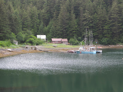
The afternoon of Monday, Jul 7 we walked downtown and toured the Bishop’s House. This is one of the few remaining buildings from the Russian era in Sitka. It served both as the residence for the Russian Orthodox bishop, and as a school. It has been marvelously restored by the National Park Service, and we had a good tour guide. It was interesting to see the building techniques used, which were a combination of techniques used for surviving Siberian winters (not necessary in mild Sitka), and shipwright techniques.
 |
| Chapel of the Annunciation, Bishop's House, Sitka, AK |
When we paid our admission we were surprised to receive our change in $1 coins. We are so used to the Canadian $1 and $2 coins, it was nice to see some American ones. I really don’t understand why they aren’t popular. They always say that they don’t make them because people don’t like them, but it seems that you rarely even see one – how can you form an opinion about something you never use? Continuing the theme of rational Canadian coinage, they have also eliminated the penny. At the store, your bill is rounded up or down to the nearest nickel.
Tuesday it rained hard all day long. We spent the day on the boat reading, doing stuff on the computer and eating. Not too interesting.
Wednesday our new autopilot arrived around midday. It then began to rain, making it very difficult to work on installation. Most of the work needs to be done outside in the cockpit and cockpit lockers. Of course, anything like this project is going to have its frustrations. The first showed itself almost immediately, as you have to choose between two parts, one designed for ½-inch wheel spokes, and the other for 5/8-inch spokes. Our spokes are 3/8-inch. There goes another couple of hours figuring out a solution to that problem. We dealt with the lack of productive work for the day by going out for dinner and spending a lot of money.
Thursday was fortunately warm with some sunshine, allowing us to make good progress on the autopilot installation. It would have been a better day to sail north, but first things first. One definition of sailboat cruising is “Repairing boats in exotic locales.” Of course we also encountered another common phenomenon found on docks. That is the tendency of people to come over and watch someone work on their boat. Actually they don’t just watch, they engage you in conversation about your work, which means that you don’t actually do any work. This makes boat work pretty inefficient.
This autopilot installation was a sobering lesson in how boat electronics has changed. The old system had two pieces with four electrical connections to make. This system has four pieces to install, and 23 electrical connections to make. We’ll see if it works better, but the possibility of a future problem seems a lot higher. Of course it has a lot more bells and whistles, and can interface with all sorts of devices that we don’t own. No one seems to make anything simple for old farts like me.
We didn’t quite get it all put together, but it got late and we were tired and hungry. The boat was a complete mess, and we were pondering dinner possibilities when André and his friend Sarah arrived. They were headed out for pizza, and invited us along – what a godsend. Sarah was also exhausted from her day. She is the head of the library here in Sitka, and in preparation for some construction work, they are moving all of the books to a temporary location. She is planning to retire on August 1, and she looks like she will enjoy it.
It was forecast to begin raining on Friday afternoon, so we thought we could finish the autopilot in the morning before it began. Well, we awoke to rain, and it never stopped. Very discouraging. We did manage to get the final cables run, bit didn’t have a chance to secure them or test them. We walked downtown and visited a small museum. It was reportedly filled with curios, but they had been mostly removed to make room for a display on the history of the Coast Guard in Sitka. That could have been interesting, but it was mostly small print signs telling us way more than we wanted to know about the bureaucracy of the Coast Guard. We then spent time at a nice bookstore, and had some coffee and late snacks to tide us over until dinner. The snacks actually pretty much killed our appetites, so we had a very late dinner, and then watched a movie on our laptop computer.
Friday the weather service got it correct – it rained all day. We erected a canvas shelter over the work area and got the cables secured and tested the system. It didn’t work. Remember those 23 connections? Jean crawled down headfirst into the lazarette to check some connections, and found that one of the Phillips head screws that held the cover on was all bunged up. The problem was that we used a Phillips screwdriver to tighten the screw, which was in fact a Pozidrive, not a Phillips. This is kind of annoying for careless people like me. Phillips screws are a bad idea in the first place. They were invented in the early days of the auto industry when they were using power screwdrivers, but didn’t have any torque-sensing capability. The screw heads were designed to strip out to avoid damaging the screwdriver or the work. So, now a century later, we are still using these crummy screws which are designed to get bunged up. The Pozidrive screw head was designed to avoid this problem with modern tools, but requires a different screwdriver; using a Phillips screwdriver on a Pozidrive screw (which looks almost identical), will bung it up. In Canada they mostly use Robertson screws, which are really superior. They were invented by a Canadian a century ago, but after a bad experience in England he refused to license the invention to anyone else. Henry Ford wanted to use these screws, but gave it up since he couldn’t get a license to make them. This leaves us Americans with Phillips screws. Well, so much for that rant – aren’t you glad you’re reading this?
So, I walked to the hardware store to get a tool to extract broken screws, and Jean finally got it out after much effort. By that time it was too late to do any circuit testing, as we had to eat dinner and walk downtown to a cello concert. Sitka has a summer music festival. There is a cello seminar going on here this week, and this was a concert by the 10 students and their two teachers. About half the students are undergraduates and half graduates, studying at places like the Cleveland Institute of Music, Julliard, the Boston Conservatory, etc. They were wonderful, and it was a welcome change from boat repairs. The concert hall has a glass wall at the back of the stage, looking out over the water, with forested islands and passing fishing boats; all very nice.
Sunday we awoke to rain, of all things. It only rained on and off all day, so we were able to work in the dry periods, and find the bad connection, and the autopilot now seems to work. Actually we need to take it out on the water so it can get the compass properly aligned, but we can do that when we leave. We’re hoping to leave tomorrow; either that or we should register to vote here in Sitka. It has been frustrating to spend so much time here waiting for parts and dry weather, but it is not a bad place to be stuck. We have electricity, so we are dry and warm, we have a free wi-fi signal at our boat, so we are informed and entertained, within a few blocks we have a grocery, a liquor store, a hardware store, and a marine chandlery, there is a good public radio station, and the town is fundamentally an interesting place. Just the same, we have been here a very long time.
 |
| Tug & Barge, Neva Strait, AK |
Monday, July 14 we finally left Sitka. It was a dry day, though not to be confused with a nice day.
The cloud layer was pretty low, hiding all of the mountains, and it was pretty cool. It had been so long since we went sailing that we actually forgot to put our long underwear on this morning, and had to add more layers as the day progressed. I expect that most of you reading this didn’t pack long underwear for your July vacation. We left town in a bit of a foul mood, as they charged us $45 because we left our dinghy in the water, rather than on deck. I’ll spare you the details, but we had heard a lot of bad stories about the woman who runs the harbor here, and they appear to be accurate.
 |
| Fido, Kalinin Bay, Kruzof Is, AK |
 |
| Forest, Kalinin Bay, Kruzof Is, AK |
The new autopilot works well, and is quieter than the old one. We again met the super-fast ferry at a narrow spot, but this time were prepared, and got out of the way; he gave us a thank you toot on his horn. We had a strong following current passing through Olga Strait, and were feeling pretty good about that until we entered Neva Strait, and found an equally strong current against us. Oh well, it all averages out. We took a small short cut entering Salisbury Sound, and things were a bit tense as we squeezed between some invisible underwater rocks, but all went well. Salisbury Sound itself was not fun, as there were closely spaced six-foot waves coming in off the ocean, and the wind right in our face. We eventually got ourselves comfortably anchored in well-protected Kalinin Bay on the north coast of Kruzof Island. It was a popular choice, with 8 other boats there.
Tuesday we got an early start to head north up the outside of Chichagof Island. The ocean wasn’t too bad - not to be confused with comfortable. In a small boat at sea you experience various levels of discomfort – comfort is not possible. The seas were 5 or 6 feet, and the wind Force 3 right on our nose. With that light wind blowing from the wrong direction, we motored for the day. The clouds were higher today, and the rugged mountains were all visible. This coast is an incredible pile of unmarked rocks, but most are visible because of the surf breaking on them. As we worked our way through them, the wind increased to Force 5, but this confusing rock pile was not a good place for a sail. It was a bit tense for a while, figuring out our location amid all of these rocks on both sides with surf breaking on them, but it all worked out fine. I probably should have put a few waypoints into the GPS to make it an easier day.
 |
| Rover, Double Cove, Chichagof Is, AK |
We went into Double Cove on Khaz Bay, and were surprised to find a power boat in there; this area is far off the normal Alaska cruise itinerary. It turned out, however, that he was not an early arrival, but rather a late departure. He raised anchor as we arrived, and wished us a good stay. As we got settled in, the sun came out! We lounged around in the cockpit, took Schooner ashore, and generally relaxed, happy that this ocean leg had gone well.
 |
| Rockweed & Barnacles, Double Cove, Chichagof Is, AK |
Wednesday turned out to be memorable. We are now in a maze of islands, protected from the ocean, and we decided to visit the site of Chichagof, an abandoned gold mining town from the early 20
th century. This is way up at the head of Klag Bay. This is a reasonably large bit of water that is entered through a narrow slot called “The Gate.” It is best to do this at slack water, but we really didn’t want to stay in Klag Bay, just wanted to visit for an hour or two. So we took whatever tidal current we got, and we got a lot. Fortunately it was running 4 knots against us, so although we made slow progress with our 6-knot boat, we had good steering control, and were able to deal with the turbulence, and avoid the shallow rocky bits.
As we approached the anchorage off the town site, we were just tooling along, thinking we were there, when suddenly the depth sounder went into a completely unexpected precipitous drop. We were arriving at low tide, and it was a minus Spring tide. We quickly threw the boat into reverse, and turned away from the shelving beach on our left. Unfortunately, we turned into a huge rock that was a foot or two under water. At that point, we weren’t going very fast, but still, we hit it very hard. In all our years of sailing, we have run aground in sand a number of times, and hit a few medium sized logs, but this is our first rock. It was a bit of a shock. A quick check of the bilge showed that we didn’t have a leak. We were then trying to decide what to do next, when the throttle lever went slack – we no longer had control over the engine. So we immediately turned off the engine, and threw out the anchor. So there we were anchored right next to the giant rock.
The throttle problem was completely independent of the rock incident, but coincidently happened at the same time. In retrospect, when going through The Gate, we had noticed that the engine wasn’t coming up to its full speed; there was something wrong with the throttle at that point, but we didn’t follow up on it. It turned out that the connection between the throttle lever and the control cable had come apart. A cotter pin had come loose, and the clevis pin holding them together had fallen out. This was relatively good news, as nothing was broken. Unfortunately, the clevis pin had fallen into the bottomless pit of the steering pedestal, and there was no way to retrieve it. We did have a variety of clevis pins with us, but none the correct size. We were able to make a temporary repair with a bolt. Of course all of this required removing the compass from the pedestal, which made the job considerably more complex.
 |
| Engine & Boiler, Chichagof, AK |
We finally were able to row ashore and check out the town. A cruising guide had said that, for many people, this was the highlight of their trip down the west coast of Chichagof Island. Well, not for us. I expect that those people were all engineers who were here 25 years ago. What we found was a varied collection of rusted metal, some of which we could identify, and most of which we couldn’t. There were also some collapsed buildings and rotting piers. In Alaska and British Columbia, it is very common to discover stuff like this when you poke around on shore. Almost every bay and cove has had an enterprise at some point in the past – a mine, a cannery, a fish reduction plant, or whatever. When these businesses shut down, it is so expensive to remove any of the equipment, that they generally just walk away and leave the industry and all of the housing and other infrastructure intact. This becomes a fascinating place to visit for several decades, but eventually the wet climate and scavengers take their toll, and it turns into miscellaneous bits of rusted metal and rotted wood.
 |
| Rusty Bits, Chichagof, AK |
Well, we took so much time repairing the boat, that by the time we got back to the gate the tide had changed, we now had a 4 knot current to fight once again. Everything went well, and we continued to Kimshan Cove. This area of Chichagof Island has hundreds of islands and thousands of rocks with maybe half a dozen navigation aids. There are hundreds of channels between the various islands, 90% of which are choked with rocks and impassable. It would be a wonderful place for a sea kayak, except for the rain and the cold. We did see one group of kayakers camped on a small island with everything spread out to dry. The narrow channels almost look like mountain lakes, except that they are full of sea lions and sea otters.
 |
| Sea Otter, Lisianski Inlet, AK |
Sea otters are such fun to watch. Most marine mammals only give you a glancing appearance, spending most of their time under water. Sea otters, in contrast, spend most of their time on the surface, lying on their backs with their head and feet sticking up in the air. They are often busy with their forepaws with something on their stomach, either food or a pup. They frequently roll over or turn a somersault, and they preen their fur to keep themselves dry. They are curious, and will get into a vertical position and swim straight up as far as possible out of the water to get a good look at us with their faces which look as if they were created by a stuffed animal designer. They don’t seem too worried about us, and generally don’t dive until we are reasonably close. While sailing we once passed closely to one who paid no attention to us at all, and we realized that he was lying on his back sound asleep.
Getting anchored in Kimshan Cove took a while. We anchored in 30 feet of water, but after half an hour we had drifted over an area with only 12 feet. Since the tide was going to drop 10 more feet in the middle of the night, and our boat draws 5 feet, this wasn’t going to work. We tried a variety of other options, and eventually we remembered that we are in Alaska, and dropped anchor in 50 feet of water. We’ll deal with getting it back up in the morning.
 |
| Troller, Kimshan Cove, Chichagof Is, AK |
After anchoring, the skies cleared, and it became sunny and warm – a delightful change. The cove was filled with salmon that were jumping out of the water. Of the five different kinds of salmon here, I think pink salmon are the ones that do most of the jumping. There was a remarkable mountain in the near distance. Above tree line the bottom was a dark rock, and then there was an immediate change to a different rock type, and the top was grayish white – probably limestone. At first it looked as if it had snow on it. Poking around on shore, Schooner and I found some rusty metal and an old gold mine. The cove is named Kimshan, which apparently is Chinese for Gold Mountain.
Thursday had another stretch of open ocean, so we spent some time putting the dinghy up on the deck, rather than towing it. Towing a dinghy in the ocean is a good way to lose your dinghy – too many things to go wrong out there. We carefully worked our way through narrow Surveyor Passage into Portlock Harbor. This was named by a Boston captain in the 1780’s who came here to trade for sea otter pelts, which were worth a fortune in China. We entered the ocean through Imperial Channel. The tide was ebbing out, and that combined with the incoming ocean swells to produce high and closely spaced waves. It was a bit unpleasant and slow going, but after we finally got out in the open ocean it was a pretty nice day, with only 4-5 foot seas and light winds. We stayed far enough off shore to avoid the off lying rocks, and then turned and headed straight into them.
 |
| Rover, Lumber Cove, AK |
We were headed for an anchorage called Lumber Cove just southeast of Lisianski Strait which separates Chichagof Island from Yakobi Island. This time I had put a handful of waypoints into the GPS, so it was slightly less tense working our way through the complex mess of rocks. Surf was breaking over them, and they were distressingly close, but we successfully worked our way into the calm and protected cove. Winter storms here must be a sight to see. There were islands 80 feet high without a trace of vegetation; seas clearly washed entirely over them. We could hear the surf from our anchorage, but the cove was very secure.
We went for an exploration in the dinghy, trying to row through Canoe Pass into the adjacent cove. The pass was presumably named because you could only get through it in a canoe, but that was a bit optimistic. We reached a dead end, and hiked the remainder of the “pass.” It might have water in it twice a year at the solstices, but it certainly didn’t have any in it today. The day had begun bright, but the clouds thickened, and eventually we had some light rain. There was no VHF radio reception, but using the short wave radio, I was able to get a few weatherfax images that indicated that we were in for a series of low pressure systems headed our way.
 |
| Leaving Lumber Cove, AK |
 |
| Stag Bay, Chichigof Is, AK |
So, we were surprised to awaken to blue skies and a few white clouds. In Alaska we just take the weather we get – predictions don’t seem to be very accurate. We worked our way through more rocks and kelp to get into Lisianski Strait. The general rule of thumb here is never sail through bull kelp, since it grows on rocks near the surface. However, we were faced with kelp growing entirely across the passage. With surf breaking on the adjacent rocks, it was a bit tense, but I went forward to look for rocks, while Jean steered through the more sparse kelp patches, and we emerged unscathed. After all these rock mazes, Lisianski Strait was a relief. It was perfectly straight, a mile wide, and 500 feet deep. Set the autopilot and enjoy the scenery, which was stunning rugged mountains rising 3000 feet straight out of the water. The sun was warm and the air cool, the wind either nonexistent or on the nose.
 |
| Boardwalk, Pelican, AK |
We finally got some nice wind when we entered Lisianski Inlet, and sailed downwind to the fishing village of Pelican. There is a cold storage/ice plant here that buys fish, and a lodge that caters to tourist fishermen. The village has a population of about 100, and is arrayed along a 12-foot wide boardwalk that runs for about a mile along the waterfront. The land behind rises in steep cliffs, and all of the buildings are built on pilings along the boardwalk. It has a post office, a library, a health clinic, a Laundromat, a café, a bar, a pizza/steak house/grocery store, a mechanic shop, an elementary school and a high school. The total student population in K-12 last year was eight. The Alaska ferry comes here twice a month in the summer. If you’re looking for an isolated spot to live, this is the place for you. It sits in a fjord with tall mountains and waterfalls all around.
 |
| Elderberries, Pelican, AK |
 |
| Pelican, AK |
After walking all around town, we went to Rose’s World Famous Bar for a beer. There were 8 or 10 men there who studiously ignored us. In fact when we sat at one end of the bar, they all moved farther down to the other end. We first thought that we were being scorned by the locals as tourists, but it turned out they were all tourist fishermen from Nebraska who had just arrived by floatplane a few hours ago, and were staying at the lodge. Should have known – they were all drinking Bud Lite. We had a good conversation with the bar tender, who is one of Rose’s 11 children. Rose, photos of whom adorn the bar, is now 81, and doesn’t tend bar anymore. The bar was decorated with items such as a lamp made from a statue of a Spanish conquistador, a stuffed salmon with the hind quarters of a deer and antlers on its head, native button blankets, carved native paddles, dollar bills hanging from the ceiling, a model of Rose’s tug boat (which she converted to a salmon troller), and so forth. Worth seeing if you happen to be in Pelican, but famous as it is, I wouldn’t travel here to see it. We’re definitely off of the tourist route here. There is only one other pleasure boat in the harbor, a sailboat from Hawaii.
 |
| Column Point, Chichagof Is, AK |
 |
| Salmon Troller, Cross Sound, AK |
Saturday, Jul 19 we left Pelican relatively early. As the day progresses, the wind blowing up the inlet increases, as do the waves. Since we are headed down the inlet, into the wind and waves, leaving early avoids most of this problem. Just the same, there were thick, gray clouds in the sky, and the wind in our faces was surprisingly cold; it was not a pleasant beginning. We skirted the southern coast of Cross Sound, which had a significant ocean swell, but was no special problem. Entering Port Althorp, the seas died down and the wind came up, so we had a short and pleasant sail up to the village of Elfin Cove. As we approached the harbor, two sea lions popped out of the water right next to the boat, and stayed with us for a surprisingly long time. They no doubt assumed we were fishermen, and anticipated some easy pickings from us.
 |
| Pt Lucan, Port Althorp, AK |
 |
| Inner Harbor, Elfin Cove, AK |
 |
| Schooner & Jeanie, Elfin Cove, AK, Jul 2014 |
As we neared the transient dock we found it packed solid, but a huge yacht (we call them gin palaces), pulled out, leaving room for three normal sized boats.
There was only one other pleasure boat; all the others were commercial salmon trollers. Elfin Cove, like Pelican is a fishing community. It doesn’t have a processing plant, but does have location in its favor. It is the harbor closest to the fishing grounds of Cross Sound and the ocean off Mt Fairweather. It is a busy place right now, but talking to an old resident we discovered that the winter population is 14 men and one woman (she’s the wife of one of the guys). This is another boardwalk village. There is a well-protected harbor, but very little flat land, so most buildings are either dug into the cliff, or built on piles over the water. It is all connected by six-foot wide boardwalks that meander around the shore and over the hills, and is very picturesque.
 |
| Head of Elfin Cove, AK |
Sunday it rained all day, and we spent it lazing around the boat, doing laundry and other exciting events. After searching all over, we found a 3-foot square with Verizon cell phone coverage, and managed to get a call through to Glacier National Park. We were able to get a 7-day permit to enter the park on Tuesday. You can’t enter the park without a permit, and they only allow 25 boats in the park at a time. Half of those can be reserved in advance, and the other half are available 48 hours ahead of time. We were pleased, and somewhat surprised to get a permit.
 |
| Boardwalk, Elfin Cove, AK |
Later, we were having a leisurely lunch at the bar, when the village was suddenly inundated by 150 Germans from a small cruise ship anchored outside. That probably doubled the population of Elfin Cove. They were all wearing identical rain gear, and carrying massive cameras. After a while a dozen or so filtered into the bar – filling it up. We made room for a couple to sit next to us, who turned out to actually be Swiss, and we had a delightful visit with them.
 |
| Floatplane Takeoff, Elfin Cove, AK |
The weather forecast for Monday was mostly cloudy with a chance of rain. In the event, it was cloudless blue sky and warm sun. Weather forecasting up here is so inaccurate. There really isn’t any good place to stay between here and Glacier Bay, so we stayed another day in Elfin Cove. With the clear skies, the view out the harbor to the north is stunning. We look out onto a massive glacier curving down out of the snow-covered Fairweather Range. This is a range of mountains that rises directly out of the sea and reaches 15,000 feet. It’s really hard to imagine. Since the timberline here is only about 1000 feet, and the snow starts about 2000 feet this time of year, the snow and glacier covered mountains are especially impressive.
 |
| Rover, Elfin Cove, AK |
We spent the beautiful day mostly on the boat, watching the fishing boats coming and going, talking to fishermen, took showers, bought food from the well-stocked, and expensive, general store, had lunch at the bar again, and generally relaxed in the nice weather. For dinner we bought some live crabs from the woman who runs the fuel dock.
 |
| General Store, Elfin Cove, AK |
 |
| Mt La Perouse, Fairweather Range from Cross Sound, AK |
Tuesday was another beautiful, sunny clear day. We got a very early start (5:30) to catch the slack tide at South Inian Pass. Even so, it was pretty swirly and unsettled. There was a thick fog bank to the west that chased us east, but never caught us. The ocean swell disappeared once we were past the Inian Islands into Icy Strait, and we made excellent time with a strong flood tide pushing us along. We had to call the National Park office on the radio to verify our permit, and get permission to enter the park. There were quite a few whales feeding near headquarters in Bartlett Cove.
 |
| Fish Tender, Cross Sound, AK |
We tied up at the enormous, incredibly expensive dock that only the federal government could afford to build. We checked in, took Schooner for a walk, and then attended a required orientation to learn all of the restrictive rules that apply to boating in the park. We were the only people there. We decided to spend the night here to make the day a bit less hectic after our early start. We could only stay at the dock for three hours, so we went a bit east and anchored. The wind came up shortly from the southwest, creating waves which rocked the boat more than we liked. So we bailed out, went ashore, and went for a long walk.
I was interested to note that there are no cedar trees here, and very few hemlocks. This was all under ice 250 years ago, and there has not been enough time for the forest to evolve much past Sitka spruce. After our walk, we settled onto the deck of the Glacier Bay Lodge and ordered a couple of beers. We nursed them for a long time while we read, watched the whales, and watched our boat jumping around. When it cooled off, we moved inside to a sofa in front of the fireplace. Eventually we went to the lodge restaurant for dinner. Unfortunately this is an example of a place that has a captive audience, and feeds them junk. The menu sounded good, but the food was not. There were large numbers of foreign tourists here, a common experience for us in National Parks, and it’s kind of embarrassing seeing them forced to eat this lousy food.
Looking out at our boat, it was still rocking, so we killed some more time until the wind died down. The waves were still there, but they would eventually stop, so we headed back to the boat. Well, the waves did eventually die down – around 3 AM, so it was a very marginal night. After several hours we had just dozed off when the stern started crashing down onto the dinghy. It sounded like someone was pounding the boat with a hammer, and Schooner was totally freaked. That didn’t help much. It was clearly a mistake to stay here.
 |
| Stellar Sea Lions, South Marble Island, Glacier Bay, AK |
 |
| Tufted Puffins, South Marble Island, Glacier Bay, AK |
Wednesday, July 23 was partly sunny, but the Fairweather Range was hidden in clouds, giving the place a very different feel. It turns out that yesterday was the clearest day they have had since June, and it lasted one day. We got two short bits of sailing in today, but the highlight was clearly the wildlife. We saw humpback whales, harbor porpoises, Stellar sea lions, harbor seals, sea otters, marbled murrelets, common murres, red-necked phalaropes, mew gulls, glaucous winged gulls,
black legged kittiwakes, tufted puffins, black oystercatchers, surf scoters, plus the usual ravens and bald eagles. There were several hundred sea lions hauled out on a few rocks. The massive bulls were continually roaring, swaying, and beating up smaller males. It looked exhausting – not easy being the top guy.
Our destination was Shag Cove in Geikie Inlet. We have decided to take the road less travelled. Virtually everyone who comes here does the same thing (including the two cruise ships allowed per day). They all go up to the head of Tarr Inlet to watch ice calve off the Margerie Glacier. There are very few good anchorages here, so the private boats all anchor in three spots. We are going to skip those spots and Tarr Inlet. Instead we’re planning to head up Muir Inlet, and stay in isolated, more challenging anchorages. Shag Cove fit the bill: there was nobody to be seen, and we had to anchor in 60 feet of water to avoid going aground on the beach.
We are anchored at the base of a 2000 foot cliff of marble, with a remarkable feature. I noticed a round hole about 1000 feet up, and looking at it through binoculars, discovered a large stalagmite sitting in the bottom of it. This is clearly a marble cave that was cut in half by the glacier, and left hanging up on the cliff. How cool is that? The night was a delightful contrast to last night – perfectly still, with only the sound of a waterfall to lull us to sleep. Actually, we were so tired from last night’s experience, that lulling was unnecessary.
Thursday was another gray cloudy day, and as we entered the main arm of Glacier Bay, there was a strong, extremely cold wind pouring south off the glaciers. This gave us an exhilarating sail, but required some additional layers of clothing. For the amusement of those of you reading this on the beach, I ended up wearing wool socks, Xtratuff rubber boots, wool long underwear, jeans, wind/rain pants, a short sleeve and a long sleeve t-shirt, a wool sweater, a fleece jacket, a rain parka, a wool hat and gloves.
We checked out a couple of marginal anchorages, and ended up tucked behind a small point in Wachusett Inlet. It was a superb spot for walking the dog; a sand beach backed by a huge meadow. It was covered with 3 or 4 inches of vegetation; mostly Pacific silverweed (Potentilla anserina) and goose tongue (Plantago maritima). It was large enough to play a softball game on – very unusual up here. Of course, walking the dog is actually illegal, this being a national park, and the National Park Service not being very dog friendly. We made a lot of noise, so Schooner couldn’t threaten any bears.
Friday we awoke to light rain. There is no VHF weather forecast accessible here, but the weatherfax map looked annoying, but not too bad. A low popped up in the Gulf of Alaska, but doesn’t have any front associated with it, and isn’t predicted to move anywhere. This is pretty common, and very frustrating to me. Every place I’ve lived, the weather came in from the west and moved east. Here, the low just sits offshore and hangs around for days, spinning clouds and rain at us, until it finally dissipates.
 |
| McBride Glacier, Glacier Bay, AK |
 |
| White Thunder Ridge, Glacier Bay, AK |
Anyhow, we have a limit on our permit here in the park, and can’t afford to hang around waiting for better weather, so we spent the day running up to the head of Muir Inlet and back. We didn’t mess around with layers of clothing; we just put on our Mustang survival suits to keep us warm and dry. We saw one powerboat and three kayaking pairs all day, so we have successfully escaped the Tarr Inlet crowd; in fact this park is remarkably empty. There was enough floating ice from the McBride glacier that we had to keep a careful lookout. We got a nice look at the Riggs glacier, and then went up to the head to see the Muir Glacier. These latter glaciers are no longer calving icebergs, having retreated back onto land. This has happened very recently, so it was interesting to see the geology and botany of land recovering from glaciation. The upper parts actually reminded me of a desert landscape, with sparse vegetation, bare alluvial fans, etc.
 |
| Riggs Glacier, Glacier Bay, AK |
 |
| Glacial Till, Muir Inlet, Glacier Bay, AK |
This also marked our farthest point north in our boat: 59 degrees, 5.3 minutes north. Now we’re headed home. As we neared our anchorage back in Wachusett Inlet, the rain increased, and I have to admit that the San Juan Islands are looking pretty attractive at this point. Two essential items for glaciers are lots of precipitation and cold temperatures; we’ve had about enough of both at this point. We’re also deep into Alaska wilderness again, which is a bit sobering, showing a rather harsh, challenging and unforgiving presence. I’m also getting tired of skulking about trying to avoid brown bears. Some sunny weather would probably improve this outlook, but at the moment I’m snuggled up to the wood stove listening to rain beat on the deck. The weatherfax maps for the next two days looks unchanged from today.
Well it rained all night, and Saturday we awoke to rain. We waved our white flag of surrender to Glacier Bay, and headed south. Two items will pretty much summarize the day: Mustang survival suits and wood stove. We anchored in the north arm of Fingers Bay, and had a quiet night listening to the rain. The bay had a large number of sea otter mother/pup combinations. The pups ride on mom’s stomach, as she swims along on her back, for several months after birth. We were able to receive the park service broadcast of the weather forecast: tonight rain, tomorrow rain, tomorrow night rain, Monday rain, Monday night rain, Tuesday rain.
Sunday we awoke to rain at the inspirational hour of 5:00. As a last insult from Glacier Bay, we had to leave early to get through Sitakaday Narrows before the tidal current turned against us, eating our breakfast as we moved. Due to the glacial till deposited near the mouth of the bay, all of the tidal water must pass through a rather narrow passage, and it moves quickly. Out in Icy Strait we found the wind on the nose from the east with the tide flooding from the west. This assured us a bumpy ride, and we had added tide rips at the mouth of Glacier Bay, and rounding Adolphus Point. There were whales about. It was actually a fairly dry day with showers, rather than incessant rain. We are now moored at the dock in Hoonah, the largest native village in Southeast, with a population of 900. The good news is that we have electricity, and have the dehumidifier running full blast. There may be hope.


No comments:
Post a Comment